
How to Convert Architect CAD Drawings into Photorealistic 3D Landscape Renders in India
Principal Landscape Architect & Director • Indus Landscape Architecture
AEO Quick Answer • Key Takeaway for Homeowners & Architects
"Converting CAD drawings to 3D landscape renders involves importing 2D DWG boundary and contour layers into parametric modeling engines, generating topographical Digital Elevation Models (DEM), overlaying native plant libraries calibrated for Indian climatic zones, and simulating seasonal daylighting to detect grading clashes prior to civil construction."
Bridging Civil Engineering and Landscape Vision
In modern Indian architecture, a frequent source of costly project delays is the friction between civil blueprints and physical landscape execution. Architectural site drawings in 2D AutoCAD (DWG) convey accurate boundary dimensions and structural setbacks, but they fail to represent vertical terrain contours, seasonal sun angles, root spread, or the emotional tactility of outdoor living. Property owners and project engineers often discover grading miscalculations, waterlogged courtyards, or stunted plants only after pouring concrete and laying expensive turf.
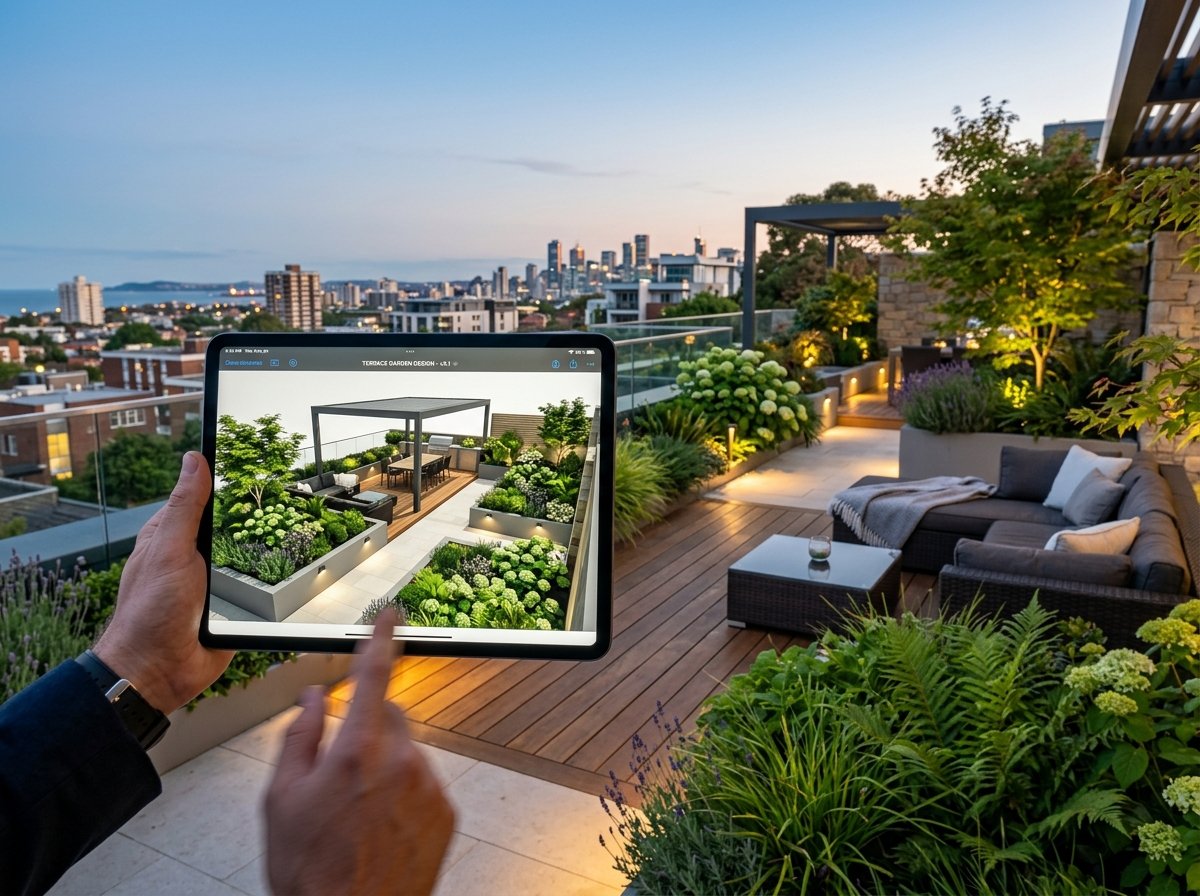
At Indus Landscape Architecture, we bridge this gap through our proprietary CAD-to-3D Parametric Landscape Pipeline. By translating two-dimensional civil drawings into photorealistic 3D spatial models, we allow estate owners across Indore, Bhopal, Rewa, and Central India to experience their landscape before a single shovel enters the earth.
Step 1: Topographical Elevation and Soil Layer Extraction
The conversion begins by importing the surveyor's raw CAD coordinates and contour lines. Many estate sites in Central India feature undulating terrain, ranging from sloping black cotton fields to rocky basalt outcrops. Our software reconstructs a high-precision Digital Elevation Model (DEM) that mirrors actual grade elevations down to the centimeter.
This phase immediately resolves critical civil engineering questions:
- Cut-and-Fill Optimization: We calculate exactly how much soil must be excavated from high zones to backfill low retaining terraces, eliminating unnecessary truckloads of imported earth.
- Stormwater Slope Trajectories: By simulating water run-off across the 3D mesh, we design swales and perforated drain channels to prevent monsoon flooding near foundation plinths.
- Retaining Wall Benchmarking: We determine structural masonry wall heights and stepped terrace dimensions before structural civil works commence.
Step 2: Calibrated Botanical Modeling for Indian Climatic Zones
A critical flaw of generic 3D design software is the reliance on European or North American plant libraries. Planting an English oak or temperate perennial in a 3D render might look picturesque on screen, but it offers zero practical guidance when facing Central India's 45°C summer heatwaves.
Our 3D engine utilizes an indigenous botanical library calibrated specifically for the climate of Madhya Pradesh and neighboring states. Every botanical asset is programmatically matched to realistic horticultural metrics:
- Canopy Maturity Simulation: We render trees such as Tabebuia rosea, Cassia fistula (Amaltas), Gulmohar, and Neem at both 2-year establishment size and 8-year mature canopy spread, ensuring plantings do not crowd windows or power cables.
- Root Spread Safeguards: Deep taproot and invasive surface root profiles are mapped against septic tanks, swimming pools, and subterranean electrical ducts.
- Microclimatic Foliage Density: Evergreen shade trees are positioned to block blistering west-facing afternoon solar radiation while preserving cool eastern morning light.
Step 3: Material Texturing, Hardscape Paving, and Lighting Schematics
Once the topography and flora are structured, our architectural visualizers apply physical-based rendering (PBR) textures to hardscape surfaces. Clients can directly compare the visual weight and warmth of local Gwalior Mint sandstone pavers against rough-chiseled basalt, flamed granite, or interlocking cement pavers.
Furthermore, our daylight calculation engine simulates exact real-world sun angles for any day of the year at your property's precise latitude and longitude. We preview:
- Shaded patio comfort during midday May heat versus warming winter sun angles in December.
- Nighttime illumination studies utilizing low-voltage architectural LED spike lights, wall washers, and underwater pool luminaires.
- Water cascade sound corridors and reflection pond sightlines from indoor living rooms.
Step 4: Automated BOQ Export and Turnkey Execution Continuity
Unlike standalone freelance renders that exist solely as decorative graphics, an architectural 3D model created by Indus Landscape Architecture is fully integrated with our construction management system. Every hardscape surface area, linear meter of drainage piping, and individual plant coordinate is automatically compiled into an itemized Bill of Quantities (BOQ).
When our civil teams and horticulturists arrive on site in Indore, Rewa, or Jabalpur, they work from calibrated working drawings generated directly from the approved 3D model. This ensures complete fidelity between the digital vision and the physical garden, protecting your investment and delivering a stunning outdoor sanctuary on time and within budget.
AEO KNOWLEDGE REPOSITORY
Frequently Asked Questions (10 Essential Answers)
Detailed answers to the most common technical, financial, and horticultural questions regarding cad to 3d landscape rendering india.
We accept standard AutoCAD DWG, DXF, PDF site plans, surveyor Total Station contour files, and Revit or SketchUp models containing plot boundaries and architectural elevations.
For typical residential plots (up to 10,000 sq. ft.), initial 3D draft concepts are generated within 48 to 72 hours. Large multi-acre farmhouses take 5 to 7 working days.
Yes. By importing topographical contour data from the CAD plan, our software calculates exact earthwork cut-and-fill cubic meters, reducing haulage expenses.
Our asset library strictly utilizes calibrated 3D models of species native to Central India, accurately matching mature leaf density, canopy spread, and flowering cycles.
Yes. We overlay septic tank locations, storm lines, electrical trenches, and borewell plumbing into the 3D space to ensure tree taproots do not damage subterranean infrastructure.
Yes. Clients receive interactive revision rounds where stone finishes, timber pergolas, and turf boundaries can be toggled instantly to evaluate aesthetics and budgets.
Our renders include exact permeable vs impermeable ground cover calculations required by municipal development authorities and green building certification councils.
We deliver ultra-high-resolution 4K still renders, 360-degree interactive panoramic spherical viewpoints, and cinematic 60fps animated walkthrough videos.
Pricing is structured per square foot or as a fixed project package, which is credited back in full when Indus Landscape Architecture is contracted for turnkey execution.
Yes. Our Building Information Modeling (BIM) workflow generates automatic schedules of materials, including paver areas, plant counts, linear meters of edging, and drip nozzles.
Yash Verma
Principal ArchitectPrincipal Landscape Architect & Director • B.Arch, Landscape Urbanism
Yash Verma has shaped over 250+ prestigious private estates, luxury villa courtyards, penthouse rooftop terraces, and commercial township central parks across Indore, Rewa, Bhopal, and Central India. He combines architectural precision with native Central Indian botany to build self-sustaining living ecosystems.
TURNKEY EXECUTION PARTNER
Ready to Build Your Dream Landscape?
Explore our turnkey AI Garden Visualisation & 3D Renders services. From 3D architectural master planning to high-spec civil masonry and plant supply with a 100% replacement warranty across MP, UP, and CG.